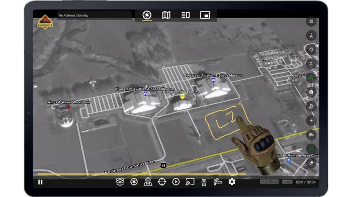
LandForm® X
Carry-On Mission Management System
LandForm® X is deployed on an Android Tablet.
Modern User-Friendly Interface
LandForm® X is easy to operate.
Competitive Price-Point
LandForm® X is offered at an affordable price.
Camera Agnostic
LandForm® X is compatible with multiple ISR Gimbal brands.
LandForm® X
LandForm® X is a comprehensive, carry-on ISR Mission Management System for Intelligence, Surveillance, and Reconnaissance (ISR) applications offering a wide variety of Airborne ISR Mission Management capabilities and situational awareness tools.
Supported Gimbals :
Multiple - Please contact us for a complete list.
Sensor Connectivity :
WIFI, Ethernet
Core Features :
Sensor Control, Geopointing, Moving Map, Target List, Geospatial AR Overlays - SmartCam3D®, DVR
FMV Annotation Tools :
Geocoding, Cross Cueing, Entity Insert, Measurement, Geospatial Telestrator
Description
Description
LandForm® X is a comprehensive, carry-on ISR Mission Management System for Intelligence, Surveillance, and Reconnaissance (ISR) applications offering a wide variety of airborne ISR Mission Management capabilities and situational awareness tools. LandForm® X is competitively priced, deployed on an Android tablet, and features a modern, user-friendly interface. With features including full sensor control with geopointing, a moving map display, target list, geospatial augmented reality, custom GIS importing, geocoding, cross-cueing, target marking, measurement, a geospatial telestrator, and a DVR, LandForm® X provides a suite of capabilities at an affordable price-point, making airborne ISR Mission Management more accessible to Tactical Flight Officers and Sensor Operators world-wide.

Share
Recent Chats
Share via email
Future: handle WhatsApp here
Future: handle LinkedIn here
Future: handle Twitter here
SUBMENU HERE
Share via Chat
Copy Link


