See us at ILA Berlin 2026 : HALL A|500
Opinion: Ensuring Air Safety Amid Proliferation Of Drones
Products & Services
Aerospace | Aviation Week Network
Aviation Week Network
https://aviationweek.com/themes/custom/particle/dist/app-drupal/assets/awn-logo.svg
Home - Aviation Group Marketing
Aviation Week Network
120 data points on over 156,000 commercial and business aviation aircraft, including military transports. Discover the most trustworthy resource for the complete aircraft history, plus ad hoc reports, month-over-month trend analysis and details on expected deliveries through 2050.
People

Andrea Rossi Prudente
Aviation Week Network

Anthony Lim
Aviation Week Network
Sales director
Becca Balmes
Aviation Week Network
Belinda Tan
Aviation Week Network
Brian Everstine
Aviation Week Network
Editor

Eddie Krankowski
Aviation Week Network
Assistant Manager, Tradeshows
erving dockery
Aviation Week Network
Lisa Tan
Aviation Week Network
Senior Marketing Manager
Mark Thomas
Aviation Week Network
Description
As the Palisades fire raged in Los Angeles, a civilian drone struck a Super Scooper aircraft that was battling the inferno on Jan. 9, leaving the aircraft grounded and with a 3 X 6-in. gash in its wing.
The collision was not an isolated incident. Drones have disrupted aerial firefighting crews repeatedly. They also have forced airspace shutdowns, struck helicopters and narrowly missed commercial aircraft.
The FAA estimates that recreational drones—a category that includes most craft lighter than 55 lb.—have reached 1.78 million units. This raises critical questions: How are these aircraft operating in increasingly crowded airspace, and what dangers do they pose?
Fortunately, such questions are being investigated by university researchers with the support of the FAA. And these experts increasingly are finding reason for caution. A team from Mississippi State University, Montana State University, Ohio State University and Wichita State University simulated 140 drone collisions with wings, vertical and horizontal stabilizers and windscreens of commercial aircraft. They found that drone strikes can cause more damage than a bird of the same size and speed.
Another serious potential danger is a drone being ingested into the engine of a jet in flight. Researchers are still learning how uncrewed aircraft systems (UAS)—composed of hard plastic, carbon fiber and metals, and containing parts such as motors, batteries and cameras—could damage commercial jet engines. More experiments and modeling are clearly needed.
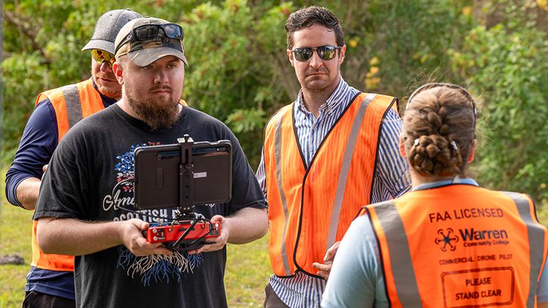
Meanwhile, Embry-Riddle Aeronautical University and Oklahoma State University researchers tracked the movements of small UAS around the Dallas-Fort Worth International Airport (DFW) over a three-year period ending in August 2021. The team collected flight telemetry data on location, altitude and speed from drones within approximately 30 mi. of the airport. By combining this information with geospatial mapping data, the researchers recorded more than 481,000 drone flights from nearly 30,000 small UAS, according to the 2024 study.
“We witnessed drone operations near approach paths into airports and very near to heliport locations,” said Ryan Wallace, associate professor of aeronautical science at Embry-Riddle and the first author of the study.
A separate Embry-Riddle study using largely the same dataset compared the proximity of the drone flights to 1.8 million aircraft operations around DFW. Using drone analytics software from Unmanned Robotics Systems Analysis, drone telemetry data was combined with air traffic data from OpenSky Network, which records aircraft flightpaths through ADS-B and Mode S signals, to run “together like a movie,” Wallace said.
The analysis revealed 24 instances in which drones came within 500 ft. of crewed aircraft. Eleven of the cases involved commercial aircraft, and 10 occurred within 1.7 mi. of a runway approach or a departure corridor. As a result, the researchers recommended that the FAA extend the exclusion zone for drones at the ends of runways to 3.5 mi. from 1 mi.
Particularly in the moments after aircraft take off or before they land, “there is an elevated risk of drones encountering manned aircraft,” Wallace said.
Since September 2023, the FAA has required that all drones over 0.55 lb. broadcast their location and identifying information through a system called Remote ID, which is like a digital license plate.
The drone data collected through Remote ID will become another critical source of information for the FAA and researchers. A team at Embry-Riddle already plans to analyze a range of data—including registration, navigation and geolocation—that can offer further insights into drone traffic and collision risks.
The data and research also will help to forecast general trends in drone flight activity across the national airspace and provide reliable observations about the effectiveness of existing regulations for small UAS.
The aviation industry and researchers recognize the value of small drones—whether in delivering medicine and food, helping track hurricanes, monitoring crops or allowing first responders to view areas that are unreachable after disasters, among countless other applications. The learnings from small drones can even be used to make aviation safer.
But the most pressing priority is to ensure that they operate safely in our airspace.
The collision was not an isolated incident. Drones have disrupted aerial firefighting crews repeatedly. They also have forced airspace shutdowns, struck helicopters and narrowly missed commercial aircraft.
The FAA estimates that recreational drones—a category that includes most craft lighter than 55 lb.—have reached 1.78 million units. This raises critical questions: How are these aircraft operating in increasingly crowded airspace, and what dangers do they pose?
Fortunately, such questions are being investigated by university researchers with the support of the FAA. And these experts increasingly are finding reason for caution. A team from Mississippi State University, Montana State University, Ohio State University and Wichita State University simulated 140 drone collisions with wings, vertical and horizontal stabilizers and windscreens of commercial aircraft. They found that drone strikes can cause more damage than a bird of the same size and speed.
Another serious potential danger is a drone being ingested into the engine of a jet in flight. Researchers are still learning how uncrewed aircraft systems (UAS)—composed of hard plastic, carbon fiber and metals, and containing parts such as motors, batteries and cameras—could damage commercial jet engines. More experiments and modeling are clearly needed.
Meanwhile, Embry-Riddle Aeronautical University and Oklahoma State University researchers tracked the movements of small UAS around the Dallas-Fort Worth International Airport (DFW) over a three-year period ending in August 2021. The team collected flight telemetry data on location, altitude and speed from drones within approximately 30 mi. of the airport. By combining this information with geospatial mapping data, the researchers recorded more than 481,000 drone flights from nearly 30,000 small UAS, according to the 2024 study.
“We witnessed drone operations near approach paths into airports and very near to heliport locations,” said Ryan Wallace, associate professor of aeronautical science at Embry-Riddle and the first author of the study.
A separate Embry-Riddle study using largely the same dataset compared the proximity of the drone flights to 1.8 million aircraft operations around DFW. Using drone analytics software from Unmanned Robotics Systems Analysis, drone telemetry data was combined with air traffic data from OpenSky Network, which records aircraft flightpaths through ADS-B and Mode S signals, to run “together like a movie,” Wallace said.
The analysis revealed 24 instances in which drones came within 500 ft. of crewed aircraft. Eleven of the cases involved commercial aircraft, and 10 occurred within 1.7 mi. of a runway approach or a departure corridor. As a result, the researchers recommended that the FAA extend the exclusion zone for drones at the ends of runways to 3.5 mi. from 1 mi.
Particularly in the moments after aircraft take off or before they land, “there is an elevated risk of drones encountering manned aircraft,” Wallace said.
Since September 2023, the FAA has required that all drones over 0.55 lb. broadcast their location and identifying information through a system called Remote ID, which is like a digital license plate.
The drone data collected through Remote ID will become another critical source of information for the FAA and researchers. A team at Embry-Riddle already plans to analyze a range of data—including registration, navigation and geolocation—that can offer further insights into drone traffic and collision risks.
The data and research also will help to forecast general trends in drone flight activity across the national airspace and provide reliable observations about the effectiveness of existing regulations for small UAS.
The aviation industry and researchers recognize the value of small drones—whether in delivering medicine and food, helping track hurricanes, monitoring crops or allowing first responders to view areas that are unreachable after disasters, among countless other applications. The learnings from small drones can even be used to make aviation safer.
But the most pressing priority is to ensure that they operate safely in our airspace.