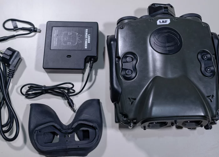
Ground Forward Air Control (GFAC) Simulator – Laser Range Finder (LRF) Simulator
Precise Target Measurement
Provides accurate distance and position data to support effective GFAC operations
Enhanced Situational Awareness
Integrates azimuth, elevation, and geo-positioning for comprehensive target information.
Realistic Binocular Simulation
Uses laser technology and binocular interface to replicate real-world target acquisition
Supports Day and Night Training
Equipped with both day and night vision modes for versatile training scenarios
Ground Forward Air Control (GFAC) Simulator – Laser Range Finder (LRF) Simulator
Experience realistic ground-to-air coordination training with our GFAC Simulator, featuring a cutting-edge Laser Range Finder. Enhance targeting precision, minimize risks, and prepare for complex mission scenarios with immersive, high-fidelity simulation.
Digital Zoom :
7x zoom capability for precise target observation.
Visibility Modes :
Day and Night Vision modes for versatile operational conditions.
Navigation System :
Digital Compass providing accurate azimuth readings
Orientation Sensor :
Inclinometer to measure elevation angles.
Distance Measurement :
Laser Range Finder for exact distance to target.
Geo-Positioning :
Latitude, Longitude, and Height data for precise location tracking
People
Description
The GFAC simulator is designed to train ground forces responsible for providing precise guidance to Close Air Support (CAS) aircraft during military operations. The primary role of GFAC personnel is to ensure air strikes accurately hit intended targets, avoid friendly fire, and minimize collateral damage.
Integral to this simulation, the Laser Range Finder (LRF) module replicates a binocular laser device used to accurately measure the distance to targets from the user’s position. The LRF module also provides critical supplementary data including azimuth (compass direction), elevation (angle of observation), and geo-position coordinates (latitude, longitude, and altitude), essential for effective communication and coordination with CAS aircraft.
The combination of the GFAC and LRF modules in this simulator delivers a realistic training experience that enhances accuracy, situational awareness, and operational readiness of personnel facing high-risk scenarios