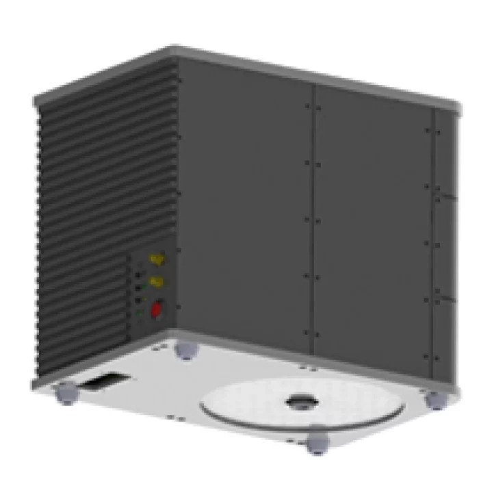
Bathymetric LiDAR System
Dual-Wavelength Laser Design
Splits 1064 nm and 532 nm with dual receivers capturing data independently.
Circular Scanning Capability
10° prism refraction enables efficient circular scanning with wide coverage.
Real-Time System Monitoring
RF module provides real-time monitoring of system status during operation.
Fully In-House Development
Designed and built in-house, eliminating reliance on foreign technology.
Bathymetric LiDAR System
Drone-based bathymetric LiDAR providing accurate shallow water depth measurement and high-resolution mapping for coastal and river environments.
Products & Services
Geospatial Information-Based 3D Structure Modeling Solution
GEOSTORY Co., Ltd
This solution follows a three-step process of input, processing, and output, utilizing imagery, DEM, AT, and spatial data to refine 3D models. The editing-based texturing function allows users to correct shape errors, occlusions, and distortions, while the automated texturing ensures consistency and accuracy through advanced geometric matching. Final outputs are stored in standard formats for broad practical applications.
Pseudo-GNSS
GEOSTORY Co., Ltd
The Pseudo-GNSS system is designed with tightly integrated firmware and hardware.
The firmware generates PRN signals based on GNSS orbital data, modulates them to resemble real GNSS signals, and ensures time synchronization in a Master-Slave structure. A user-friendly GUI software enables easy device control.
The hardware consists of a power unit, signal transmission unit, and communication unit. The power unit ensures stable supply through low-noise design, while the transmission unit radiates GNSS-like signals indoors. The communication unit supports Wi-Fi and wired connections for synchronization and control across multiple devices, with compatibility for smartphones and tablets to display positioning results.
People


Description
Our LiDAR uses a custom-designed laser that separates 1064 nm and 532 nm wavelengths from a single source, with two dedicated receivers capturing each set of data independently.
Inside the system, the linear laser beam is refracted at a 10-degree angle through a prism to enable circular scanning. An RF module is also integrated for real-time equipment status monitoring.
From circuit board design to component selection, every part of this system was developed in-house by multiple institutions.
As a result, we have successfully eliminated reliance on foreign technology.